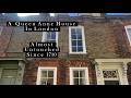
 Gellatly Road is another SE14 border road – SE15 starts at the bottom of the gardens of the houses on the western side. It is also the edge of the Telegraph Hill conservation area, made up of the housing built by the Haberdashers Company in late Victorian times. Most of the houses have details like the head and foliage decorations (the pictured example is from no.58). The Doctor’s surgery at 42 Gellatly Road also has a rare surviving example of the ornate tiles that once lined the doorsteps of all these houses.
 The Haberdashers company do not seem to have been too good at providing for the social needs of residents beyond housing – the only pub and the only shop in the conservation area (excepting those on New Cross Road) are situated on Gellatly Road. The latter is the superior cornershop ‘Gellatly Supermarket’ the former is Skehans pub (formerly
Mcconnells and before that the Duke of Connaught), South London’s premier Irish-Thai establishment. The décor inside the pub includes a mixture of Irish and Thai bric-a-brac, such as musical instruments, and behind the pub in a converted stable block is a proper Thai restaurant, Chai’s Garden. The food is generally excellent. Back in the pub there’s a quiz night on Tuesdays and usually music at the weekends.
One of the notable features of the road is how busy it is, forming as it does part of the B2142. Compare the completely different feel in the parallel Bousfield Road, identical in many respects but without the traffic. It is one of the idiosyncrasies of traffic control in the area that most vehicles are channelled up this relatively narrow road, while the wide boulevards of Jerningham and Pepys Road are kept relatively quiet. The sweeping corner from Lausanne Road into Gellatly Road has always struck me as particularly dangerous, enabling cars to zoom round without being able to see people crossing to the shop.
Still at least the traffic is tempered a bit by the speed humps, the result of a successful campaign in the early 1990s by local residents who staged actions including crossing the road continuously during the rush hour and hiring skips to slow down the traffic. Funnily enough the story of the Battle of Gellatly Road is told in a school textbook, Geography in Action (1995), as an example of neighbourhood campaign to improve city life.
The name of the road changes to Drakefell Road as it passes the junction with Kitto Road and heads over the hill and down towards Brockley Cross. As well as the Victorian terraces and 20th century council blocks (Fern Court) there is an interesting 2-storey wooden structure, Greenstreet Hill, a self-build housing project developed by a housing co-op in the 1990s. It backs on to Telegraph Hill Park and brings some of the feel of the park on to the road with hazel bushes covering the front, from behind which a model of Anubis watches the traffic (not a rabbit statue as I once thought).
Next to Greenstreet, and entirely hidden by a large hedge, is another interesting building – one of the last prefab bungalows in the area. These white ‘temporary’ buildings were put up on bomb sites after World War Two with an expected life of ten years, but many survived 50 years or more. A row of them on Kitto Road were only demolished in the 1990s to make way for the new housing opposite the park.
As we move down Drakefell Road we cross from SE14 to SE4 – are we still in New Cross? For the purposes of my Walking New Cross project I am assuming that New Cross=SE14, but I know it’s not that simple. Some people who live in Gellatly or Drakefell might describe themselves as living in New Cross, others Telegraph Hill, some Nunhead or Brockley depending on their precise location. And it’s always been this way – a search through the adverts in The Times newspaper shows how these roads, and indeed the wider area, have always moved around on people’s mental map of South London:
- an advert in 1889 gave an address at ‘94 Drakefell Road, St Catherine’s Park, Peckham’ (Times 15.8.1889);
- Arthur Jackson, a Professor of Music, was mentioned as living in ‘Drakefell Road, Nunhead’ (Times 22.6.1892);
- the birth of a son to James Garrett took place at ‘122 Drakefell Road, Hatcham’ (Times 5.6.1897);
- the death of Caroline Clark took place at ‘Drakefell Road, Brockley’ (21.6.1906) ;
- a fundraising concert for a hospital ambulance took place ‘per Mrs Huggett and Mrs Everett’ at ‘Drakefell Road, New Cross’ (Times 27.11.1914).
Brockley, Peckham, Hatcham, New Cross, Nunhead or even the now-forgotten St. Catherine’s Park – take your pick.


4 comments:
Thanks for the interesting and informative post. I always wondered about the story behind Greenstreet Hill.
I always think of the top part of Drakefell road as Telegraph Hill, and the bottom as Brockley, but it is very vague isn't it, especially when Nunhead station is so close!
Watch out for a review of Chai's Garden on Brockley Central. We were in there last week, and thought it was rather good too!
I too have always fpund that corner, from Lausanne Road into Gellatly Road, very dangerous. The end of Kitto Road, the corner with Skehan's on it, is very dangerous to cross too.
Many of the drivers don't even indicate as they come round the corner, the way the roads are laid out makes people think it is just one continuous road. Just sharpening the corner so it was more of a right angle would make a big difference to the speed.
You may be interested in William Booths observations of the area especially socio economic demarcations.
http://tinyurl.com/ya87ynp > then click > From this page > find nearby pages in survey notebooks eg http://tinyurl.com/yjm99rk
Post a Comment